Lightwood Strategic | Priors Farm Site
Lightwood Strategic will deliver a new community around a linear park set between an eastern and western neighbourhood at Priors Farm. The masterplan will accommodate circa 850 homes, and includes a neighbourhood centre and the Market Square with mixed uses likely to host small local businesses.
In the south east of the site and to the south of Easthampstead Road, a large expanse of semi-natural open space for recreation will be landscaped and will enhance habitat value compared with the existing arable use. The proposed use (SANG) secures a long-term green wedge which may be linked to additional SANG that others are promoting further south on Newlands Farm.
Design Approach
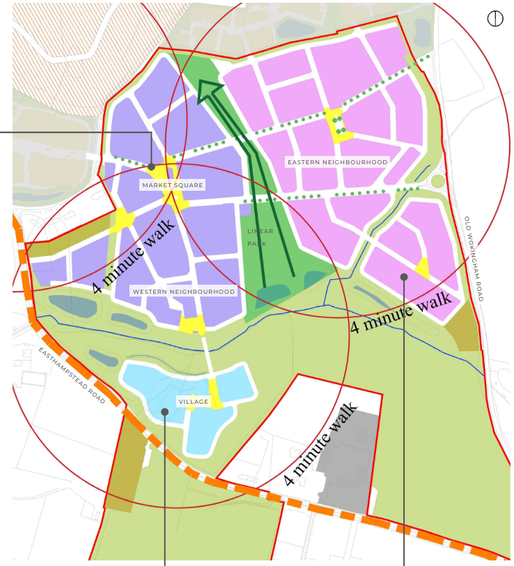
The Priors Farm site covers approximately 56.779 hectares and is currently utilised for agriculture and equestrian purposes. The northern part of the site mostly comprises a single very large field and is proposed for housing development. Near to Old Wokingham Road, a small drainage ditch, imperceptible in the landscape, creates a sub-area within it. To the east, there is a small area of equestrian character associated with two properties next to the Byway.
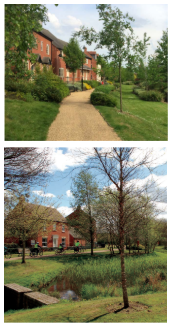
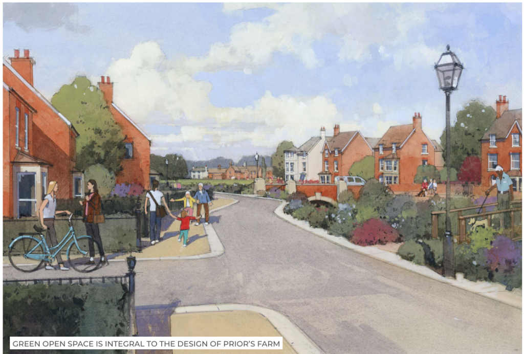
The development proposals divide this large open area into eastern and western neighbourhoods, organised on either side of a linear park which brings green open space into the heart of the development, helping to mediate the transition from an urban environment to a more rural one.
At the base of these neighbourhoods, a further field ditch traverses the site along which a key of the green infrastructure strategy will coalesce, enhancing the watercourse into a more appreciated and valuable landscape and habitat feature.
To the south of the western neighbourhood, the existing Hambridge Farm forms part of the wider Priors Farm masterplan. Here, several structures have been developed over the last dozen years, creating a previously developed feel. The development proposals here exhibit a more intimate, village like character, nestled in greenery with soft and organic edges and a small village green at its centre. It is more rural in character, distinct from the two more urban neighbourhoods to the north.
The Neighbourhood Centre, set within the Market Square, is within four minutes’ walk of each of the local neighbourhood centres and provides a more urban feel. It is connected to the eastern square to generate a framework for a traditional pattern of streets.
In the south east of the site and to the south of Easthampstead Road, a large expanse of semi-natural open space for recreation will be landscaped and will enhance habitat value compared with the existing arable use. The proposed use (SANG) secures a long-term green wedge which may be linked to additional SANG that others are promoting.
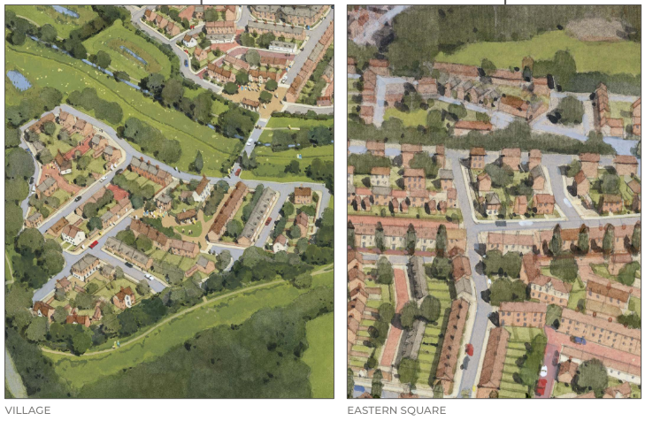
Public Squares
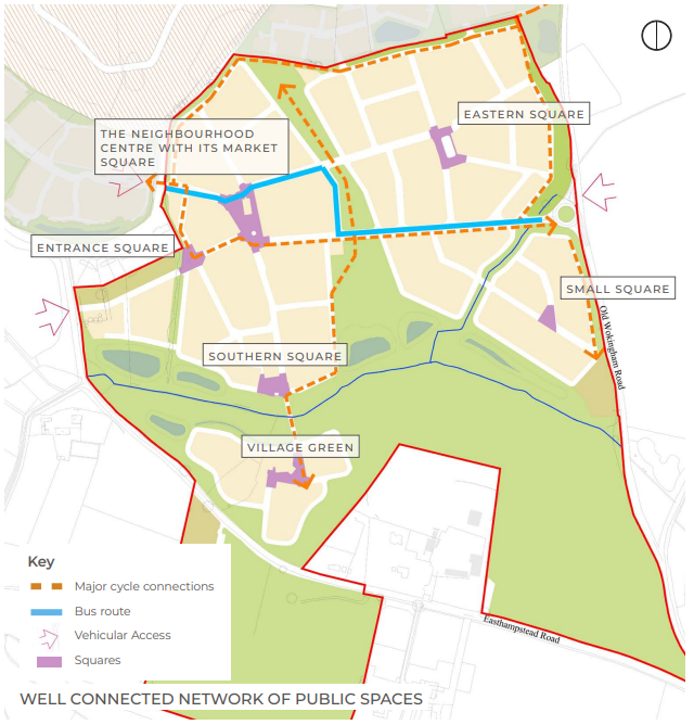
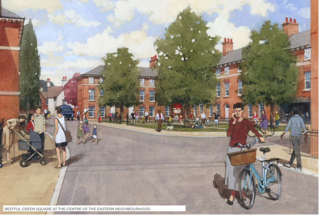
A variety of public squares are envisaged within the development, each serving a different purpose, and having a distinct character to respond to its location. The Eastern Square, for example, is an enclosed residential green square with railings, tall trees and benches; whilst the Southern Square has a more rural feel, open to the riparian and the wetland meadows, overlooking the Village and open countryside to the south.
Market Square
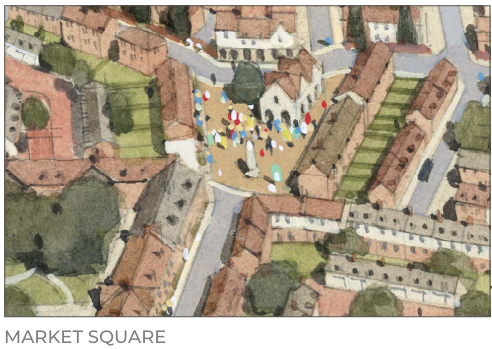
The Neighbourhood Centre with its Market Square will be the true centre of the community. With a shared surface throughout and no north south traffic, the square could house public events, markets, and small festivals. At its heart is a community building with covered space for markets at ground floor and a hall above for the community to use. Mixed use buildings have been designated within the square to allow small local businesses like bakeries and cafés to thrive and give focus to the community.
The main road with a bus route runs through the northern end of the Market Square connecting it with the Eastern neighbourhood, Pearces Farm site, the core SDL and Wokingham centre beyond. A network of cycling routes, streets and walks ensures that it is easy to get around the development and to connect to other proposed off-site active travel routes.

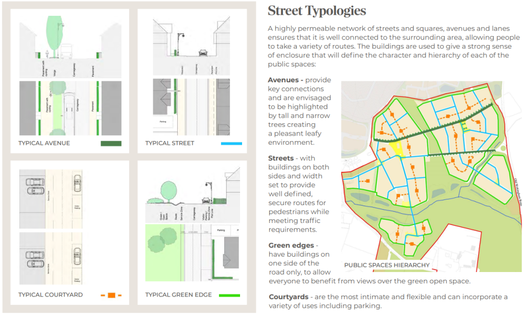
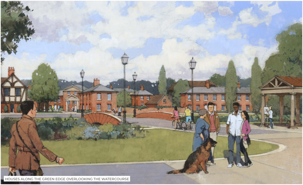
The Masterplan
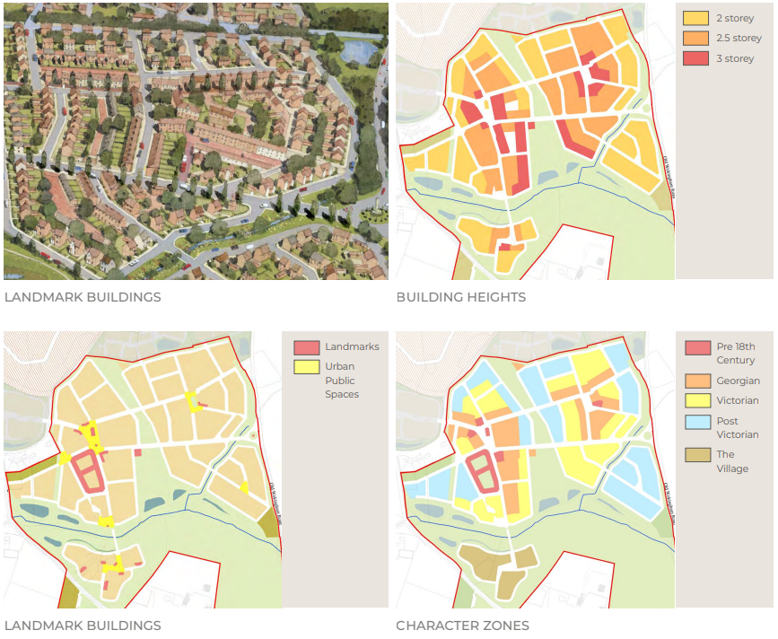
Surveys show that people respond best to architecture that is responsive to its local and historic context in style, scale and choice of materials. The character of Wokingham derives from its historic connections with the silk trade. This has manifested in the architecture and form of the historic town centre and its immediate environs.
The illustrative masterplan conveys an approach to the creation of a new part of Wokingham. It also draws on the character of the surrounding area. This ensures that it has an identity connected with the town and that it also sits comfortably as part of the transition into the wider countryside.
The masterplan will accommodate different types of properties including: affordable housing, market housing, larger and smaller properties, houses, apartments and coach houses, and shops. Detailed design can consider working locally or from home.
This approach will encourage people to put down roots in the development, fostering a diverse community in an attractive environment that meets people needs.
Landscape


